Maps: 1623 - 1650
1627 John Speed: "A NEWE MAPE OF
POLAND." Possibly from his "A Prospect of
the Most Famous Parts of the World," first
published by George Humble in 1627.
From cichecki.net/bebeln0
POLAND." Possibly from his "A Prospect of
the Most Famous Parts of the World," first
published by George Humble in 1627.
From cichecki.net/bebeln0

1628 Gerard Mercator:
"LITHVANIA," 16 1/2 x
14 1/2 inches / 420 x
370 mm, from one of
the last unaltered
editions of Mercator's
atlas -- the 1628 French
edition.
"LITHVANIA," 16 1/2 x
14 1/2 inches / 420 x
370 mm, from one of
the last unaltered
editions of Mercator's
atlas -- the 1628 French
edition.

| 1630 Jan Cloppenburgh (publisher) - Pieter van den Keere (engraver) - Gerard Mercator (cartographer): 'LITHUANIA," from "Atlas Minor Gerardi Mercatoris Atlas sive Cosmographicae Meditationes...," 11 x 8.5 inches, published 1628-52. First 1630 version from the National Library of Lithuania: lnm.lt;; uncolored 1630 version from old-leaf on eBay; 1632 from Old World Auctions. |


| 1633 Gerard Mercator: "LITHVANIA." Engraved in Duisburg circa 1590, printed in Amsterdam 1633. 43.5 cm x 37 cm. Mercator's three-volume “Atlas, sive Cosmograph- icae Meditationes de Fabrica Mundi” was first published 1595. J. Hondius reissued the atlas from 1604-34. Dates for maps from this atlas are most often guesses. AK-05. |

1634 Willem Blaeu:
"PRVSSIAE NOVA
TABVLAE," Amsterdam.
19.5 x 15 inches. Also a
DETAIL image.
From www.raremaps.com
"PRVSSIAE NOVA
TABVLAE," Amsterdam.
19.5 x 15 inches. Also a
DETAIL image.
From www.raremaps.com
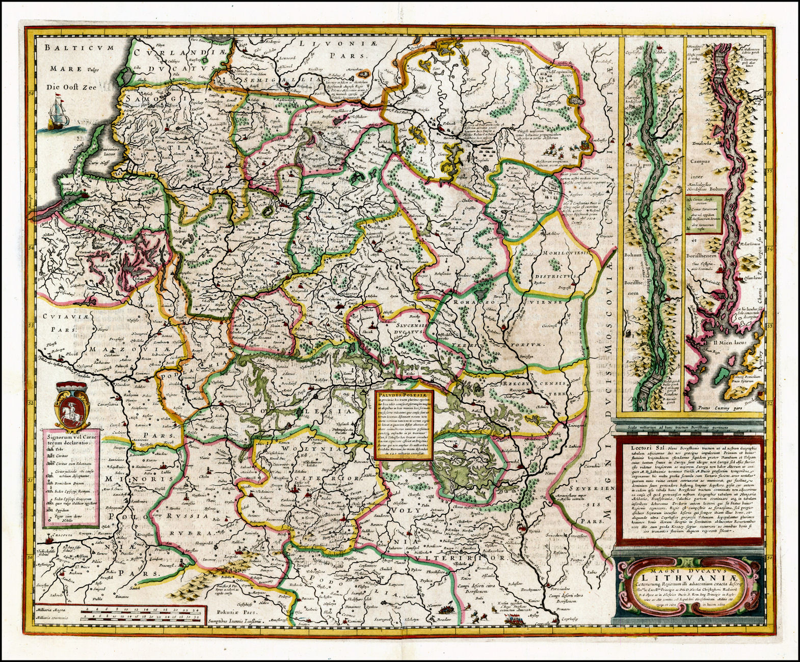
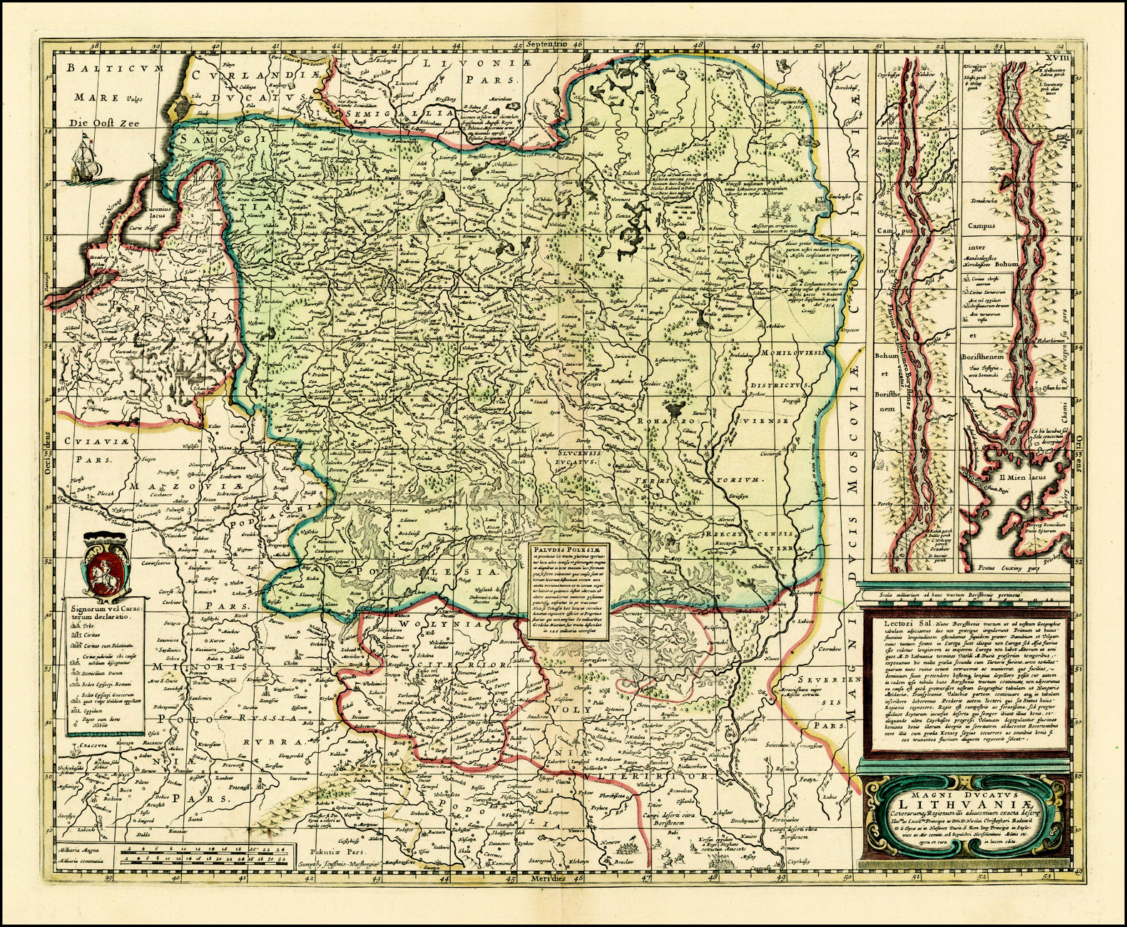
Johannes Janssonius "MAGNI DVCATVS LITHVANIAE," Amsterdam, 22 x 18.5 inches, in a version published 1636 on the left, followed by two
1640 versions, and a 1650 version (followed by an enlarged detail from that map). Compare with the 1699 version of the same map. The 1650
version and detail image are from Old Leaf, on eBay
1640 versions, and a 1650 version (followed by an enlarged detail from that map). Compare with the 1699 version of the same map. The 1650
version and detail image are from Old Leaf, on eBay


1638 Matthaus Merian: "MAGNI
DVCATVS LITHVANIAE," Frankfurt,
12.75 x 14.5 inches. From his
"Topographia Germaniae." AK-26
DVCATVS LITHVANIAE," Frankfurt,
12.75 x 14.5 inches. From his
"Topographia Germaniae." AK-26
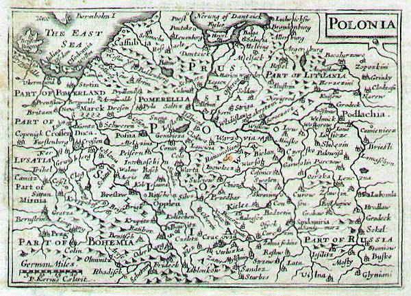
1646 Speed - Pieter van
den Keere (engraver):
"POLONIA," London, 8.6
x 12.3 cm. From
www.robertfrew.com
den Keere (engraver):
"POLONIA," London, 8.6
x 12.3 cm. From
www.robertfrew.com
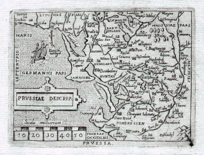
1647 Abraham Ortelius:
"PRVSSIAE DESCRIP."
Venice, from Pietro
Querini's 1647 edition of
Abraham Ortelius'
"Theatro del Mondo."
"PRVSSIAE DESCRIP."
Venice, from Pietro
Querini's 1647 edition of
Abraham Ortelius'
"Theatro del Mondo."
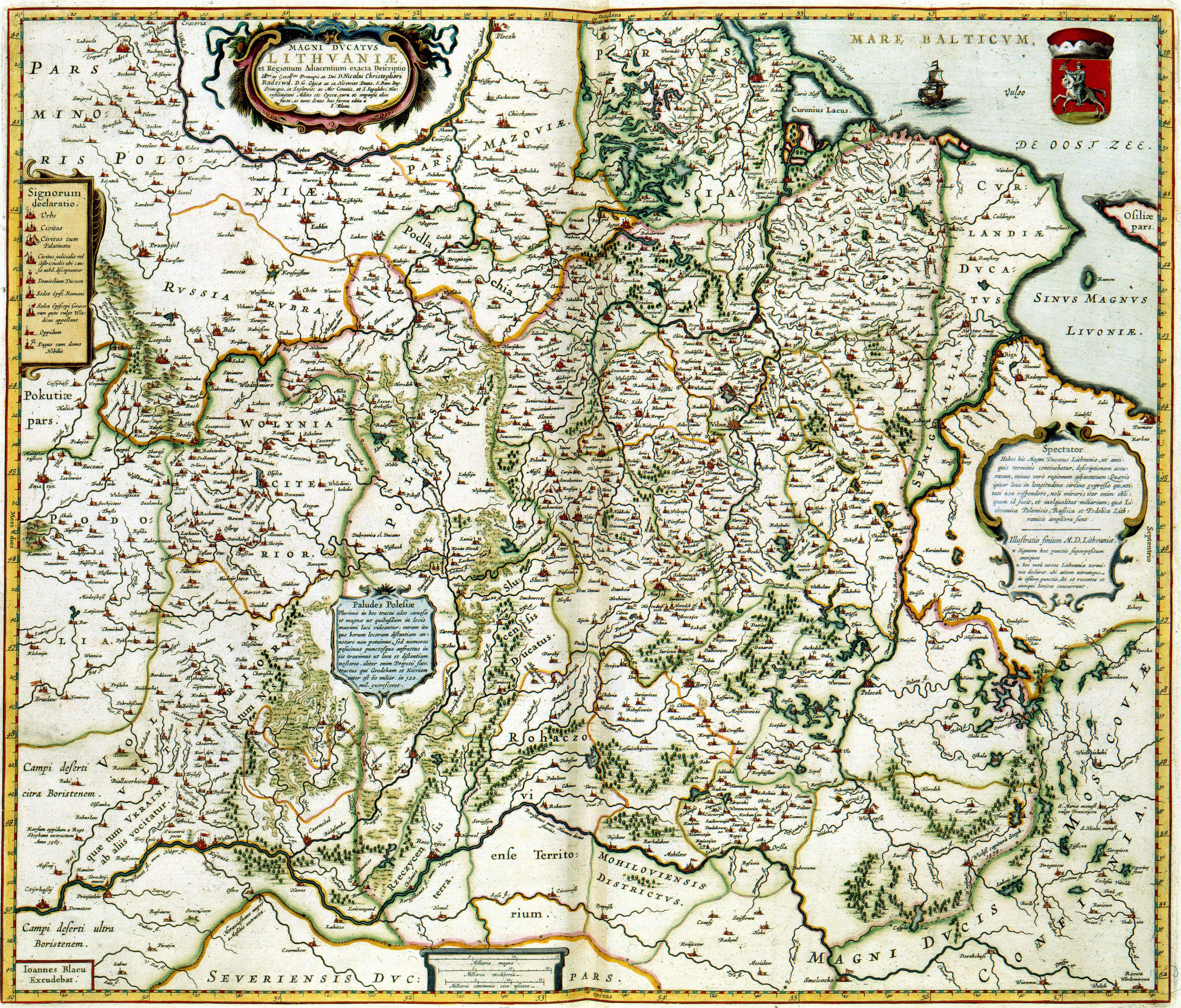
1648 Willem Blaeu: "MAGNI DVCATVS
LITHVANIAE," dedicated to the Radziwils,
Lithuanians who ordered Maciej Strubicz
to map the area in 1584-95. In 1613
Johannes Jansonnius published a Hessel
Gerritsz- engraved copy of that map;
Blaeu copied and published it in 1648.
From Konnklijke Bibliotheek, The Hague
LITHVANIAE," dedicated to the Radziwils,
Lithuanians who ordered Maciej Strubicz
to map the area in 1584-95. In 1613
Johannes Jansonnius published a Hessel
Gerritsz- engraved copy of that map;
Blaeu copied and published it in 1648.
From Konnklijke Bibliotheek, The Hague

1649 Philippe Briet: "LE
ROYAVME DE POLOGNE."
195 x 155 mm, Paris, from
" Theatre Geographique de
Europe." From
www.antiquarius-sb.com
ROYAVME DE POLOGNE."
195 x 155 mm, Paris, from
" Theatre Geographique de
Europe." From
www.antiquarius-sb.com

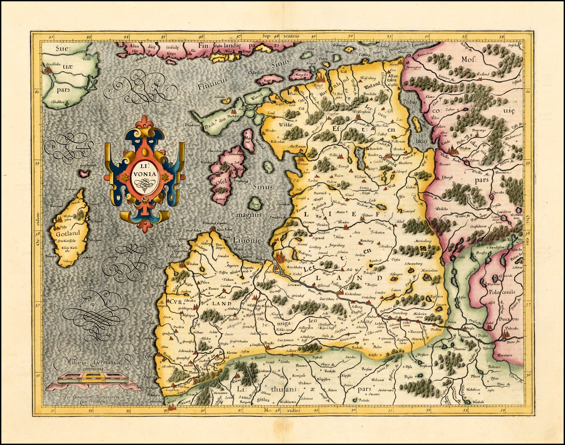
1630 Johannes Janssonius: "Livonia,"
Amsterdam, 18 x 14 cm, from Mercator's
"Atlas Minor." From www.nlib.ee
Amsterdam, 18 x 14 cm, from Mercator's
"Atlas Minor." From www.nlib.ee

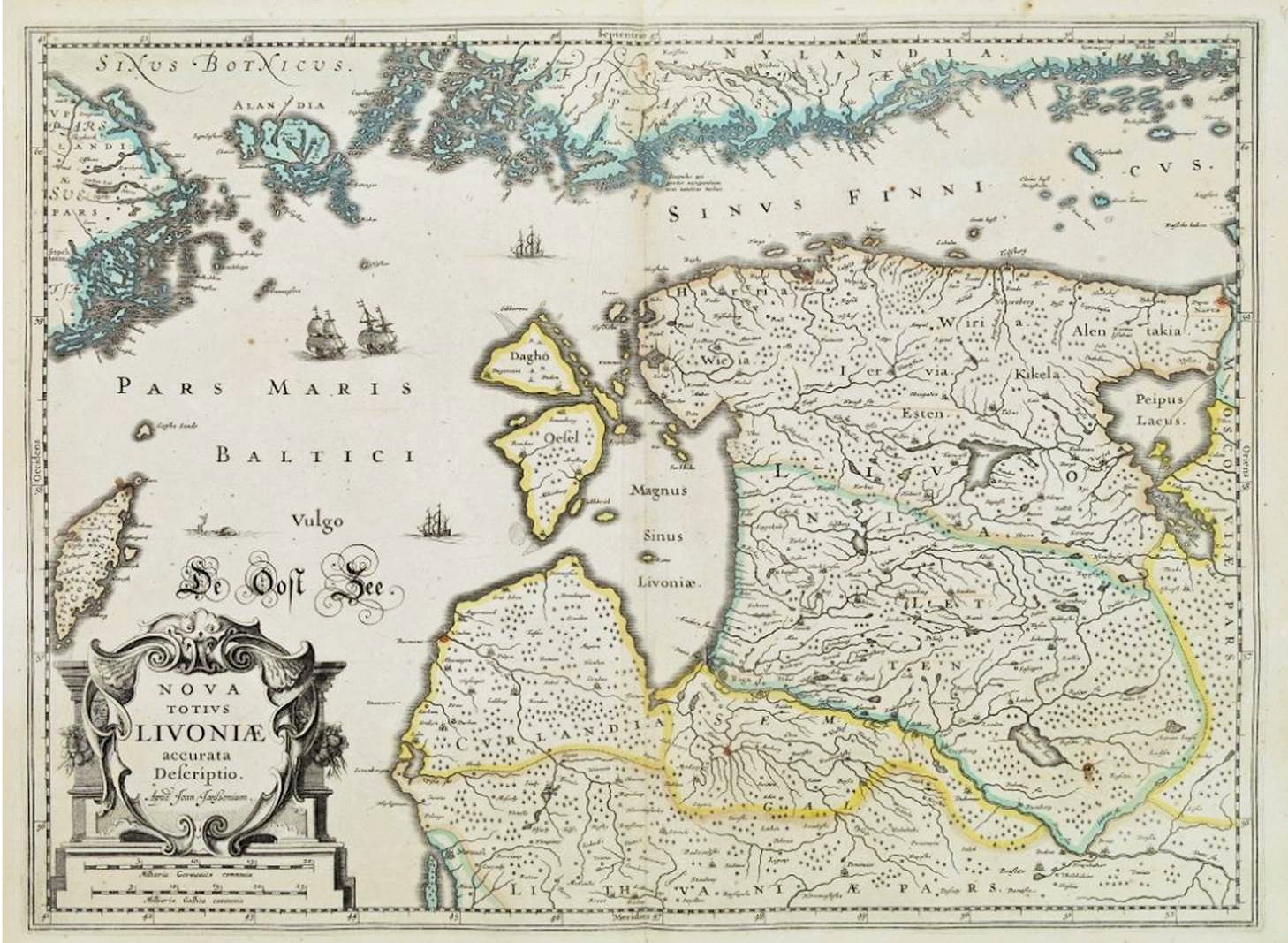
1636 - 1642 versions of Johannes Janssonius: "NOVA TOTIVS LIVONIAE accurata Defcriptio.," Amsterdam, 20.5 x 15.5 inches / 50 x 37 cm, from
"Nouveau theatre du mode ou nouvel atlas." The first, 1636 version is from www.raremaps.com; the 1637 is from www.swaen.com; the 1638 and 1641 versions are from
the Unv. of Tartu: http://dspace.utlib.ee/dspace/handle/10062/2896; the 1642 version is from www.nlib.ee
"Nouveau theatre du mode ou nouvel atlas." The first, 1636 version is from www.raremaps.com; the 1637 is from www.swaen.com; the 1638 and 1641 versions are from
the Unv. of Tartu: http://dspace.utlib.ee/dspace/handle/10062/2896; the 1642 version is from www.nlib.ee
1623 Gerard Mercator: "LITHVANIA,"
Amsterdam, 44 x 37.5 cm/ 17 x 14.5
inches, from his "Atlas sive
Cosmographica," first published in 1595.
From www.raremaps.com
Amsterdam, 44 x 37.5 cm/ 17 x 14.5
inches, from his "Atlas sive
Cosmographica," first published in 1595.
From www.raremaps.com


1630 Gerard Mercator's 1627 map, reissued by Hondius: "LIVONIA," Amsterdam, 47 x
36 cm / 18 x 14 inches, in two different versions. Map on the left from www.jpmaps.co.uk; map
on the right from www.raremaps.com
36 cm / 18 x 14 inches, in two different versions. Map on the left from www.jpmaps.co.uk; map
on the right from www.raremaps.com
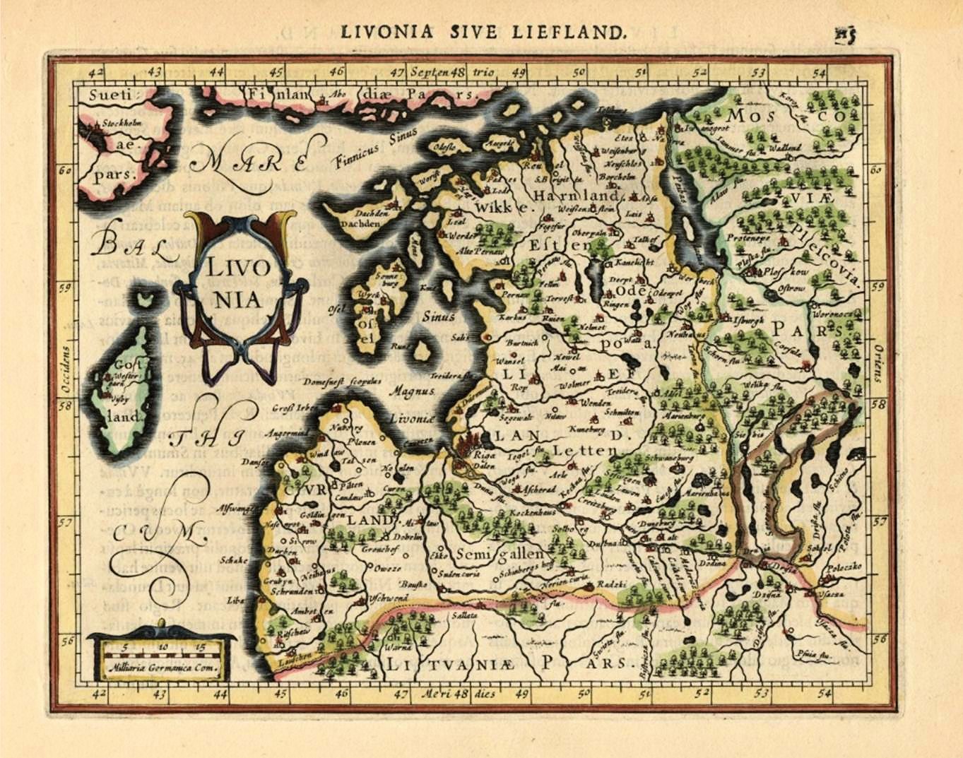
1628 Gerard Mercator - Jodocus Hondius: "LIVONIA SIVE LIEFLAND," Amsterdam. From
Mercator's "Atlas Minor," as issued by Hondius. Map on the left from www.swaen.com; on the right,
from the Unv. of Tartu: http://dspace.utlib.ee/dspace/handle/10062/2896
Mercator's "Atlas Minor," as issued by Hondius. Map on the left from www.swaen.com; on the right,
from the Unv. of Tartu: http://dspace.utlib.ee/dspace/handle/10062/2896


1625 Willem Blaeu:
"Ryghsche Bodem"
Amsterdam, from his
"Het Licht der Zeevaert"
(Atlas of the Seas). North
is on the left, as is Reval
(Talinn), Riga is at the
top, and Memel on the for
right. From the Unv. of Tartu:
http://dspace.utlib.ee/dspace
"Ryghsche Bodem"
Amsterdam, from his
"Het Licht der Zeevaert"
(Atlas of the Seas). North
is on the left, as is Reval
(Talinn), Riga is at the
top, and Memel on the for
right. From the Unv. of Tartu:
http://dspace.utlib.ee/dspace


1648 Joan Blaeu: "LIVONIA, Vulgo Lyefland," Amsterdam, in both uncolored and colored
versions, from Joan Blaeu's "Atlas Theatrum Orbis Terrarum," published 1646 - 1655 in
six volumes. Both images from DSpace at the Univ. of Tartu: http://dspace.utlib.ee/dspace/
versions, from Joan Blaeu's "Atlas Theatrum Orbis Terrarum," published 1646 - 1655 in
six volumes. Both images from DSpace at the Univ. of Tartu: http://dspace.utlib.ee/dspace/

1647 Adam Olearis: "MARE BALTHICVM
oder Ost See." From DSpace at the Univ. of Tartu:
http://dspace.utlib.ee/dspace
oder Ost See." From DSpace at the Univ. of Tartu:
http://dspace.utlib.ee/dspace


c1640 Jan Jansson: "NOVISSIMA POLONIAE
REGNI DESCRIPTIO." Amsterdam, 21 x 17
inches. From http://www.raremaps.com/
REGNI DESCRIPTIO." Amsterdam, 21 x 17
inches. From http://www.raremaps.com/


1635 Gerard Mercator: "LIVONIA OR
LIEFLAND." From the National Library of
Latvia:http://data.lnb.lv/nba05/karte
s/frame_anglu.htm
LIEFLAND." From the National Library of
Latvia:http://data.lnb.lv/nba05/karte
s/frame_anglu.htm

1625 Gerard Mercator:
"LITHUANIA," Paris, 5.5 x
8 inches, from his "Atlas
Minor," first published in
1607. Compare with
1620 versions. From Beach
Antique Maps & Prints on eBay
"LITHUANIA," Paris, 5.5 x
8 inches, from his "Atlas
Minor," first published in
1607. Compare with
1620 versions. From Beach
Antique Maps & Prints on eBay
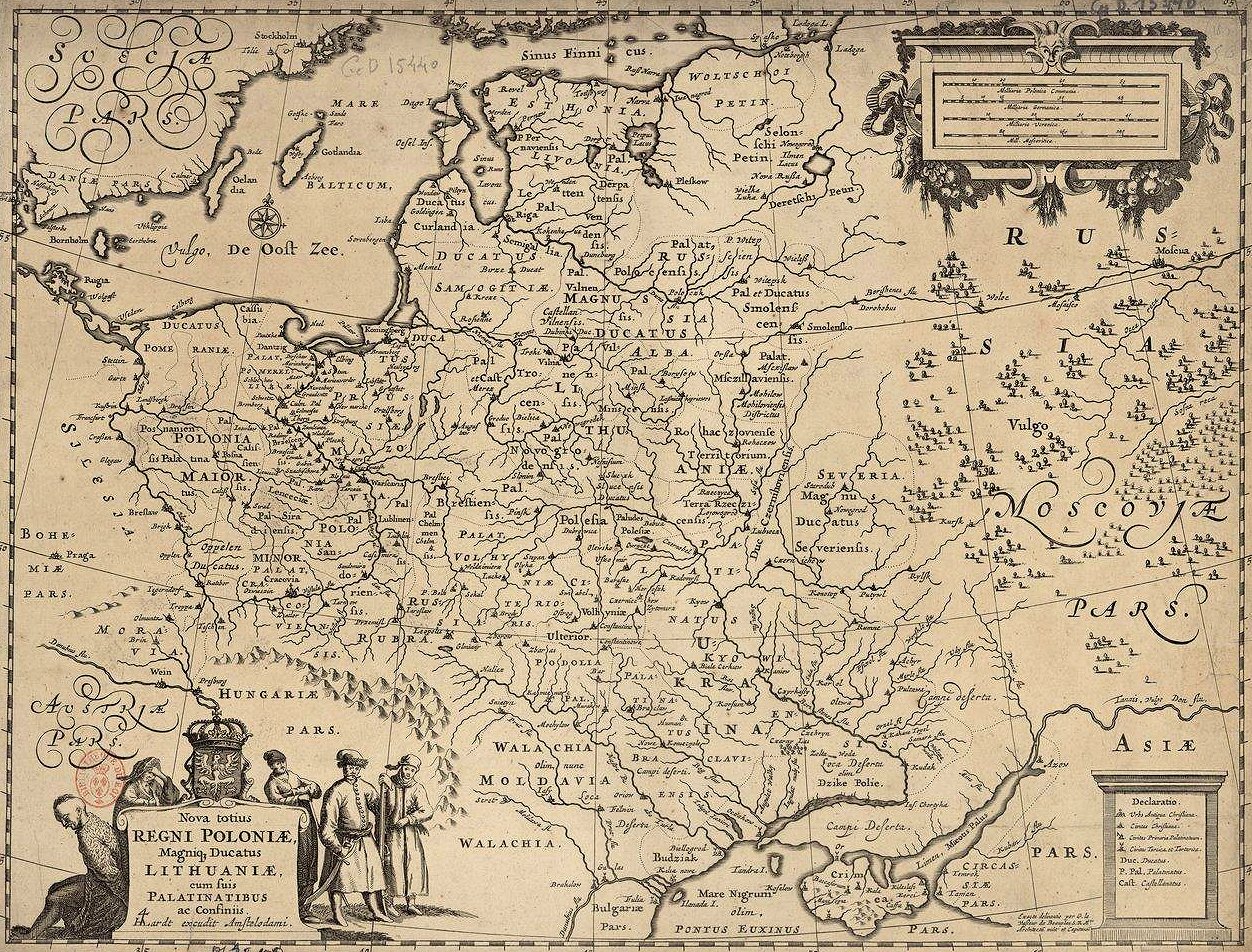
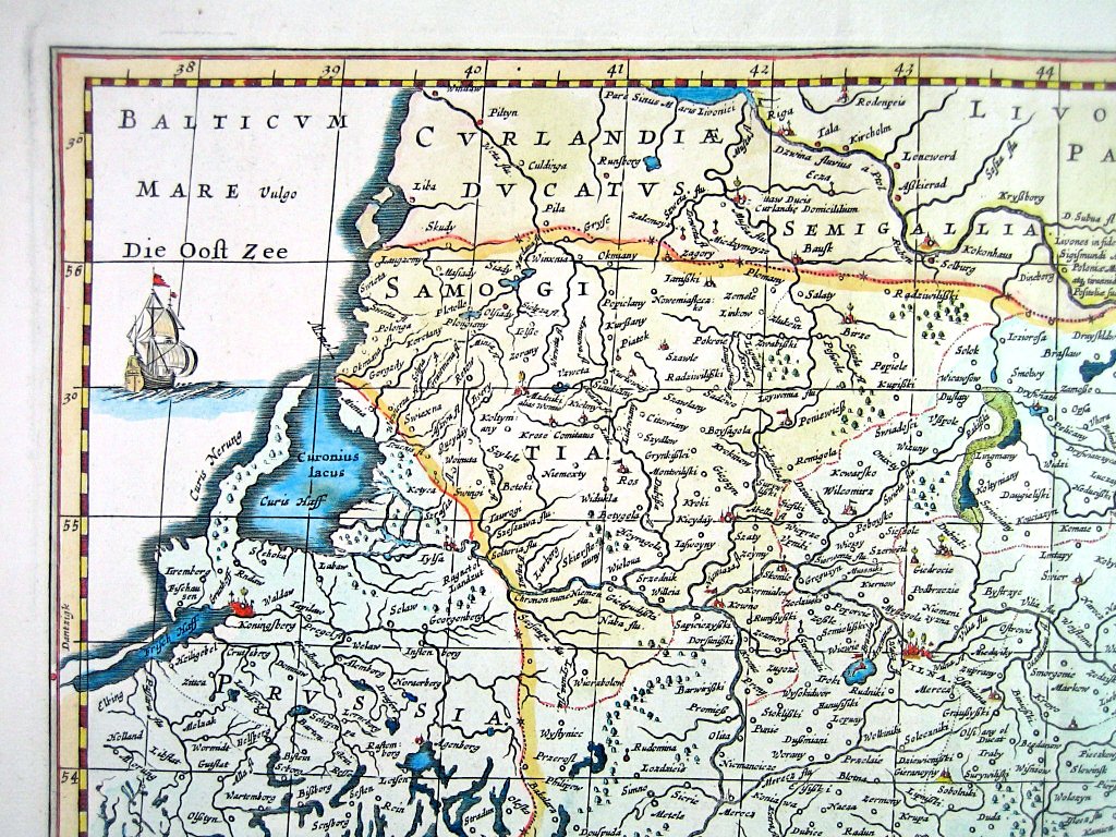
1630 Guillaume Le
Vasseur de Beauplan:
"Nova totius REGNI
POLONIAE, Magniq.
Ducatus LITHUANIAE...,"
51.5 x 39.5 cm. From
Bibliotheque nationale de
France: www.gallica.bnf.fr
Vasseur de Beauplan:
"Nova totius REGNI
POLONIAE, Magniq.
Ducatus LITHUANIAE...,"
51.5 x 39.5 cm. From
Bibliotheque nationale de
France: www.gallica.bnf.fr
1636 1637 1638 1641 1642

1630 1630 1630
1632
1636 1640 1640 1650


1625 Jodocus Hondius - Gerard Mercator: "LIVONIA,"
London, map 152 x 190 mm, in an English edition.
From The National Library of Latvia:
http://data.lnb.lv/nba05/kartes/frame.htm
London, map 152 x 190 mm, in an English edition.
From The National Library of Latvia:
http://data.lnb.lv/nba05/kartes/frame.htm