Maps: 1501 - 1552
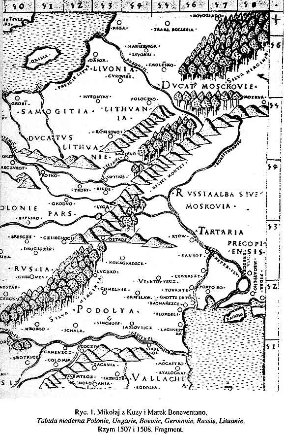
1507 Beneventano:
"Tabula moderna
Polonie..."
"Tabula moderna
Polonie..."

1511 Sylvanus: DETAIL
image of his world map in
cordiform (heart- shaped)
projection. Complete map:
1511 B. Sylvanus world
map ENTIRE
image of his world map in
cordiform (heart- shaped)
projection. Complete map:
1511 B. Sylvanus world
map ENTIRE
1513 Martin
Waldseemuller: "Tabula
moderna Sarmatiae..."
Waldseemuller: "Tabula
moderna Sarmatiae..."
1536 Martin
Waldseemuller:
"SARMATIA"
Waldseemuller:
"SARMATIA"

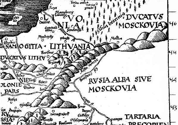
1541 Lorenz (Laurent)
Fries - Claudius Ptolemy -
M. Servetius: "Tabula
Nova Poloniae," Lyon.
12.09 x 14.29 inches.
Servetius (Publisher) was
tried by Calvin for
heresy, and burned at
the stake along with a
number of his books. From
www.alexandremaps.com
Fries - Claudius Ptolemy -
M. Servetius: "Tabula
Nova Poloniae," Lyon.
12.09 x 14.29 inches.
Servetius (Publisher) was
tried by Calvin for
heresy, and burned at
the stake along with a
number of his books. From
www.alexandremaps.com

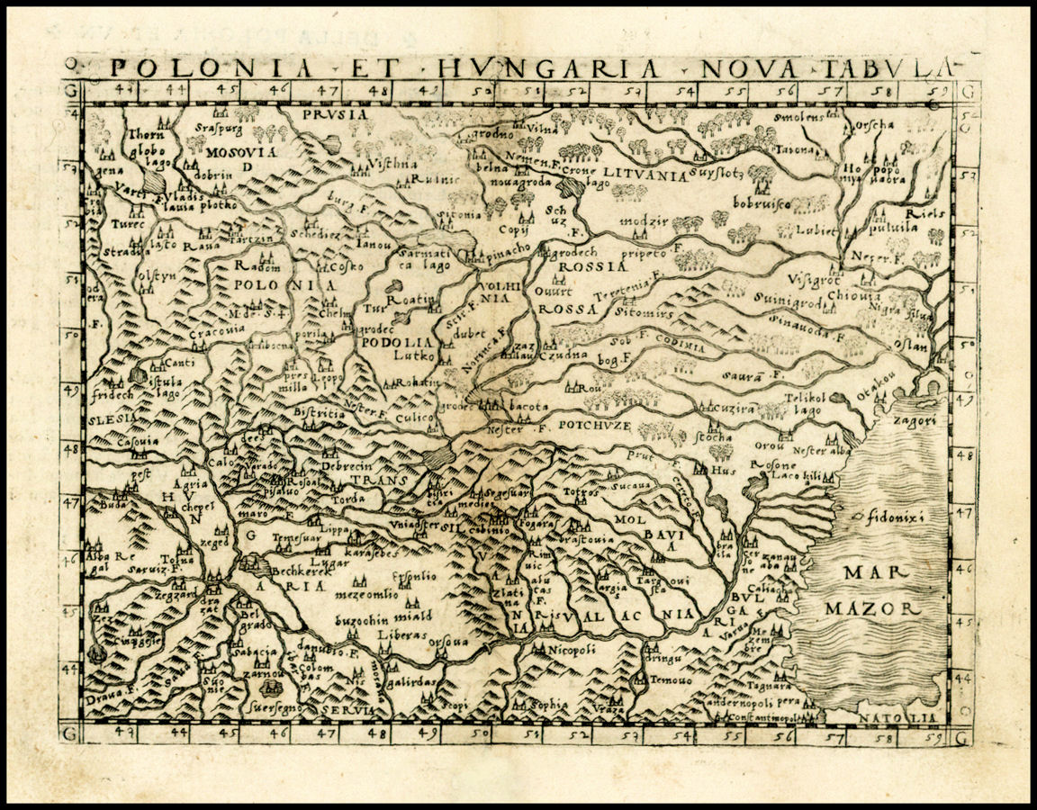
1548 Giacomo Gastaldi:
"POLONIA ET HVNGARIA
NOVA TABVLA." From
Gastaldi's edition of
Ptolemy's "La Geografia..,"
begun 1542, published in
Venice in 1548. From
www.raremaps.com
"POLONIA ET HVNGARIA
NOVA TABVLA." From
Gastaldi's edition of
Ptolemy's "La Geografia..,"
begun 1542, published in
Venice in 1548. From
www.raremaps.com
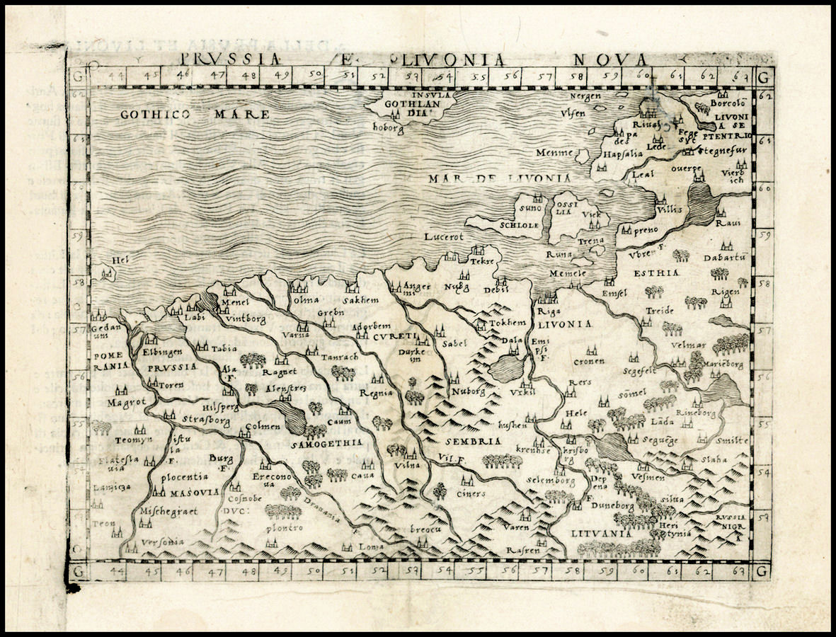
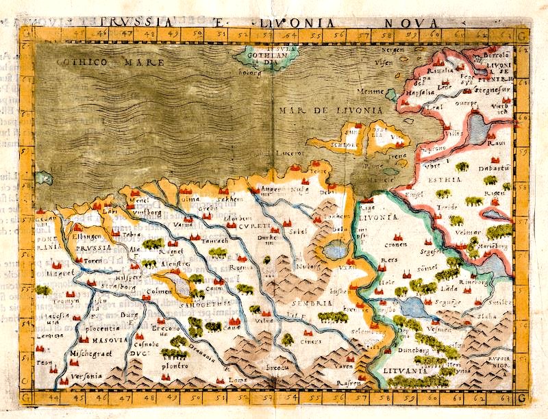
1548 Giacomo Gastaldi: "PRVSSIA ET LIVONIA NOVA."
Based on a map by Claudius Ptolemy , in uncolored
and colored versions, from "La Geography." Colored
version from National Library of Estonia: www.nlib.ee
Based on a map by Claudius Ptolemy , in uncolored
and colored versions, from "La Geography." Colored
version from National Library of Estonia: www.nlib.ee

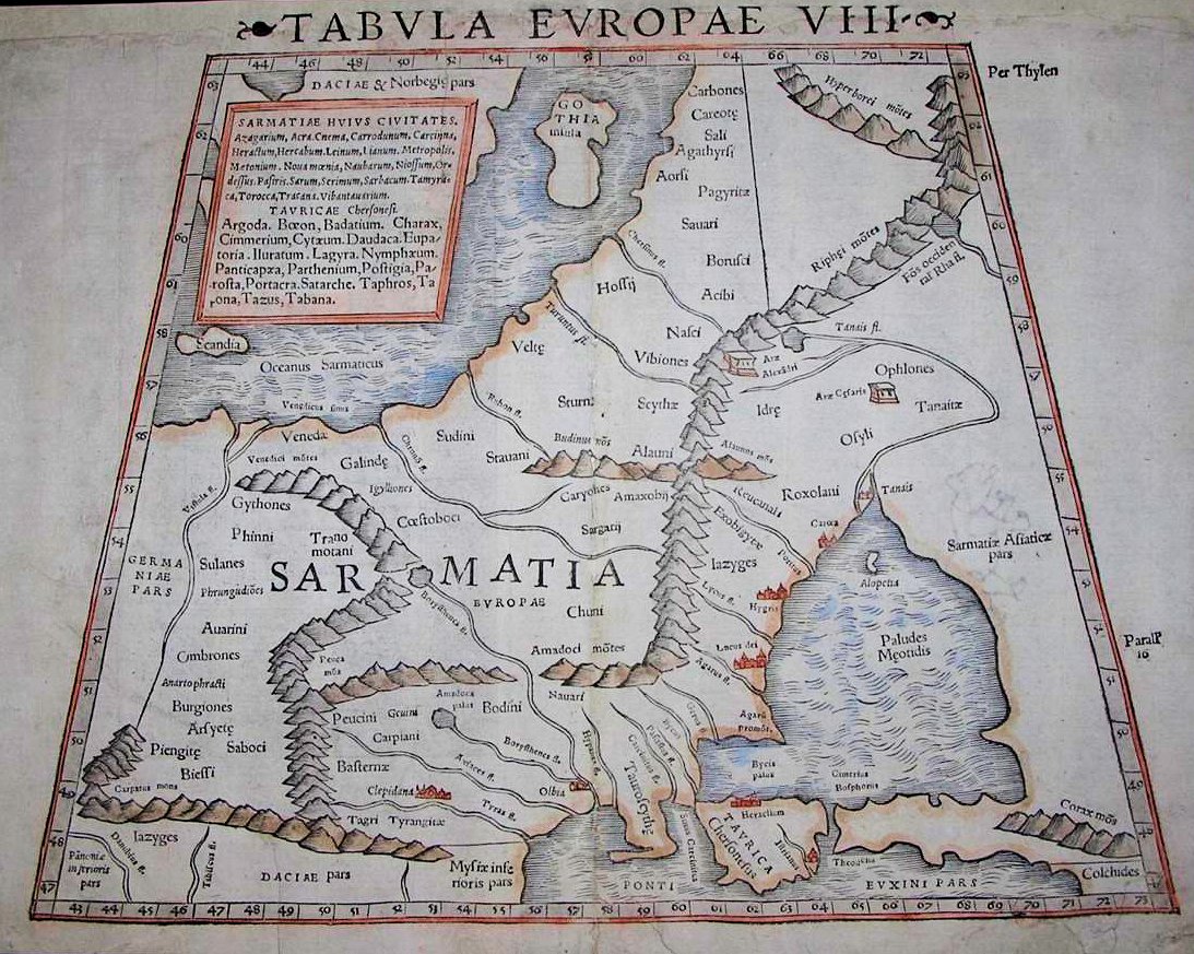
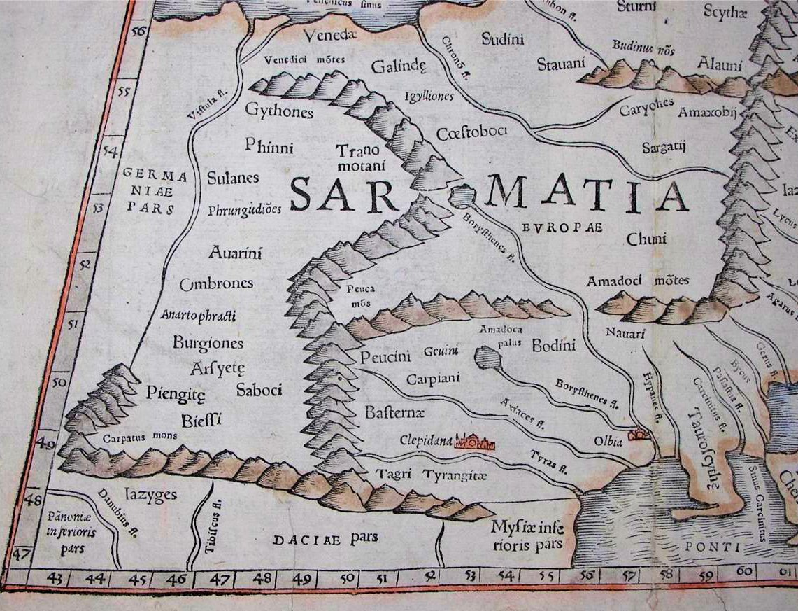
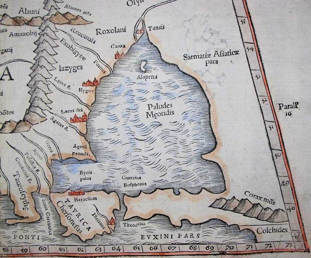
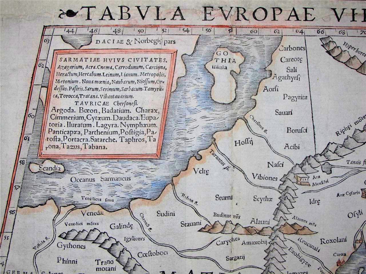
1548 Giacomo Gastaldi:
"TABVLA EVROPAE
VIII."
"TABVLA EVROPAE
VIII."

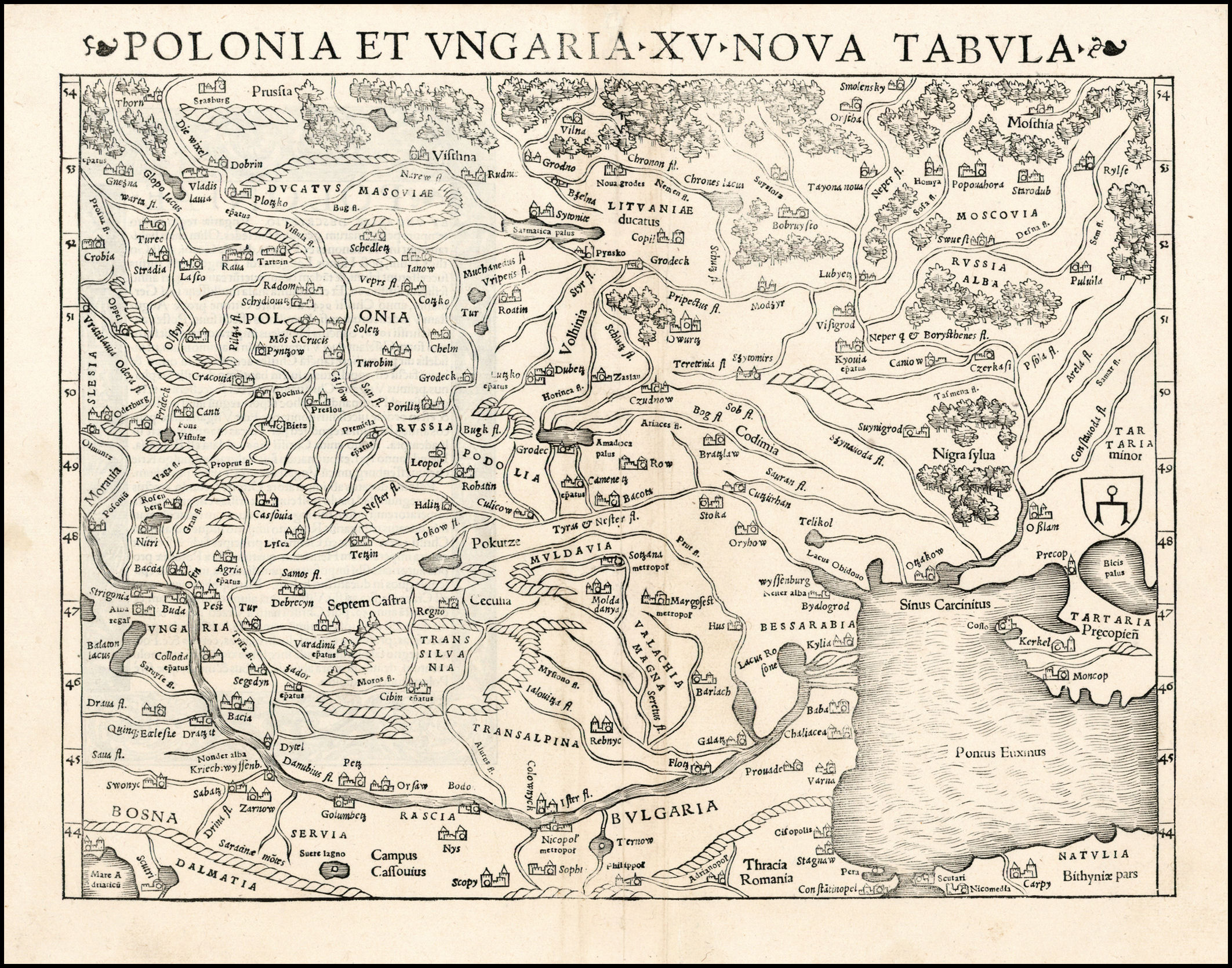
1550: "POLONIA ET VNGARIA XV NOVA
TABVLA."
TABVLA."

1550: "Landtafel des Ungerlands/Polands
/Preussen/Littaw/Walachei/ Bulgarei."
/Preussen/Littaw/Walachei/ Bulgarei."
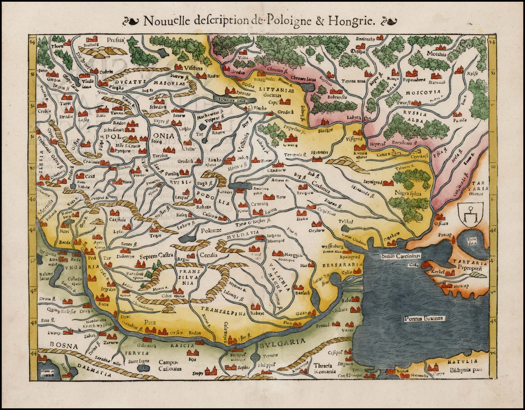


1552: "Nouuelle defcription de Poloigne &
Hongrie," Basle. AK-27
Hongrie," Basle. AK-27
1552: "POLONIA ET VNGARIA XX NOVA
TABVLA."
TABVLA."
1552 Sebastian Munster: "SEPTENTRION-
ALES REGIONES XVIII NO TAB."
ALES REGIONES XVIII NO TAB."

1520 Abraham Ortelius:
"TABVLA.MODERNA.SAR
MATIE...POLONIE..." From
the National Museum of
Lithuania.
"TABVLA.MODERNA.SAR
MATIE...POLONIE..." From
the National Museum of
Lithuania.


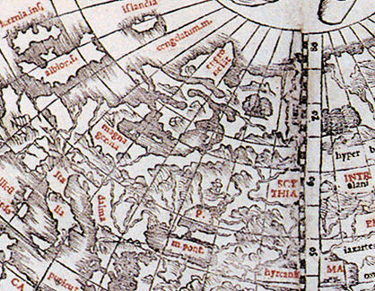
1535 Lorenz (Laurent) Fries: (Untitled),
Strassburg, 18 x 12 inches. from an
edition of Ptolemy's "Geographia"
published by Melchior and Gaspar
Trechsel. From www.raremaps.com
Strassburg, 18 x 12 inches. from an
edition of Ptolemy's "Geographia"
published by Melchior and Gaspar
Trechsel. From www.raremaps.com

1540, 1542 Sebastian Munster: "EVROPA PRIMA NOVA TABVLA,"13.5 x 10 inches / 33
x 27 cm, Basle, in both the first, 1540 edition on the left, and the 1542 version on the
right, both woodcuts from his "Geographia," the first atlas to include maps of every
continent. The left, 1540, map is from jpmaps.co.uk; the right, 1542, map is from www.raremaps.com
x 27 cm, Basle, in both the first, 1540 edition on the left, and the 1542 version on the
right, both woodcuts from his "Geographia," the first atlas to include maps of every
continent. The left, 1540, map is from jpmaps.co.uk; the right, 1542, map is from www.raremaps.com

1548 Johann Stumpf: (Europe), 15 x 12
inches, Zurich. Rare untitled variant
edition of Stumpf's map of Europe, oriented
with south at the top, from his
"Schweytzer Chronick." From
www.raremaps.com
inches, Zurich. Rare untitled variant
edition of Stumpf's map of Europe, oriented
with south at the top, from his
"Schweytzer Chronick." From
www.raremaps.com


| 1542, 1545 Sebastian Munster: "TABVLA EVROPAE VIII," 10.9 x 13.3 inches, text in Latin, in from "Geographia Universalis, Vetus et Nova, complectens Cladii Ptolemaei Alexandrini enarrationis libros VIII" (first edition 1540), published by Heinrich Petri. Also a DETAIL images of the 1542 and 1545 maps compared. 1542 map from www.sanderusmaps.com; 1545 map from lusarag on eBay |

1550 Giacomo Gastaldi: "Desciptione de la
Moscovia..." Venice, 15.5 x 10.5 inches,
based on the work of Baron Sigismund von
Herberstein, who had visited Moscow
twice as Emperor Maximillian I's
ambassador to Russia. From
www.raremaps.com
Moscovia..." Venice, 15.5 x 10.5 inches,
based on the work of Baron Sigismund von
Herberstein, who had visited Moscow
twice as Emperor Maximillian I's
ambassador to Russia. From
www.raremaps.com
1542 1545
1542 DETAIL 1545 DETAIL

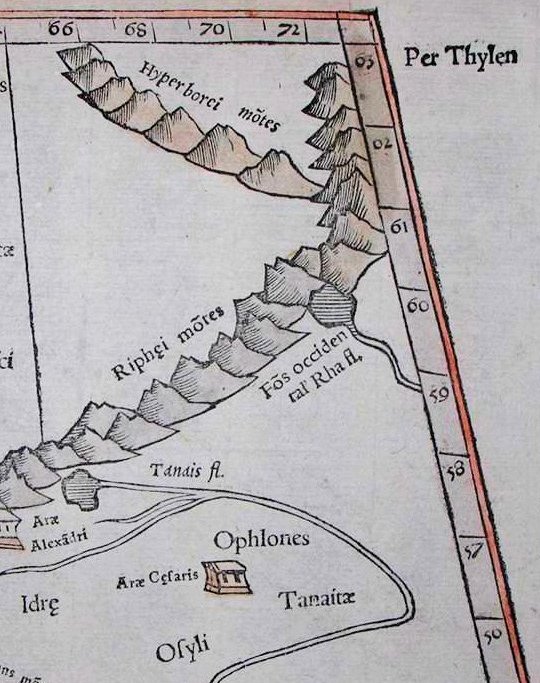
1545 DETAIL images
| The same 21 words are listed in each version, but the list has been reset: 1542's "Badatiu" has become "Badatium" in the 1545 version |
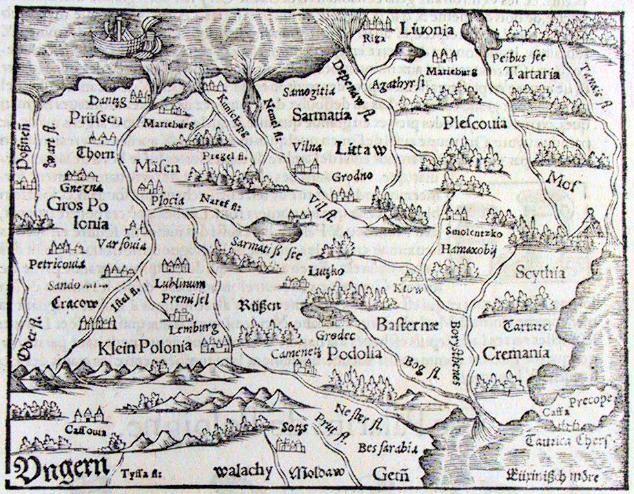
1545 - 1560 Sebastian Munster: "Poland and Hungary," from the same plate, 14 x 10 inches, as published in his "Cosmographia Universalis."
with 500 woodcuts, and 24 double-page maps, from 1544 until 1628.
with 500 woodcuts, and 24 double-page maps, from 1544 until 1628.

1550: "POLONIAE ET VNGARIAE NOVA
DESCRIPTIO." Basle. From www.raremaps.com
DESCRIPTIO." Basle. From www.raremaps.com

1560: "Nuoua descrizzione della Polonia, &
dell' Vngaria." From www.raremapscom
dell' Vngaria." From www.raremapscom

1545: "Landtafel des Ungerlands/Polands
/Preussen/Littaw/Walachei/ Bulgarei."
From http://digital.ub.uni-duesseldorf.de/
/Preussen/Littaw/Walachei/ Bulgarei."
From http://digital.ub.uni-duesseldorf.de/